Github
https://github.com/nsutanto/ios-PhotoMap
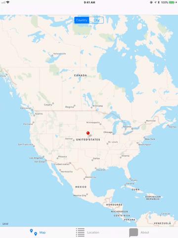
The Photo Map app downloads and stores user images and their data from user's instagram account. The app will parse image information, especially location data (longitude and latitude) where the photo is taken. The app then will perform reverse geo location to find out the country and city where the photo is taken. The app can display the photo location as map view or table view. The user will able to display the location based on country or city.
API used : Instagram, Google
Technical Features
Use NSURLSessions to interact with a public restful API Create a user interface that intuitively communicates network activity and download progress Store media on the device file system Use Core Data for local persistence of an object structure
Requirement
XCode 9.1
Swift 4


Swift 4
Instagram Login

Display Map Pin as Countries and Cities


Display Table View as Countries and Cities


Populate images based on country
Populate images based on city
Swipe images left and right
Re-share your image